| Title | YAMAP -Social Trekking GPS App |
| Version | 10.12.1 |
| Price | Free |
| Category | Common |
| Package | jp.co.yamap |
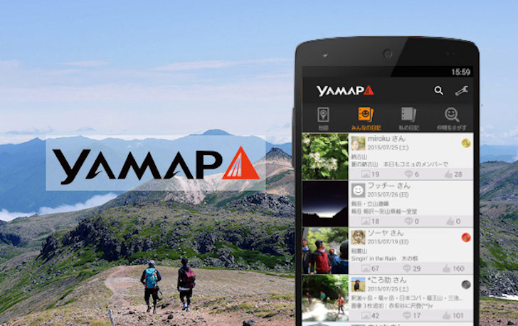
YAMAP - Social Trekking GPS App transforms your smartphone into a reliable outdoor companion, fully optimized for hikers, trekkers, and nature lovers who want to explore trails safely and share their adventures with a like-minded community. Whether you are a seasoned mountaineer tackling challenging peaks or a casual weekend wanderer discovering local paths, YAMAP combines precise GPS navigation, offline map functionality, and a vibrant social network to enhance every step of your journey. The app is designed to keep you connected even in remote areas where cellular signals fade, offering detailed topographic maps, real-time tracking, and an intuitive interface that makes planning and recording trips effortless. With YAMAP, you can not only navigate confidently but also discover new routes contributed by fellow trekkers, log your personal achievements, and inspire others through photos and stories. This is more than a navigation tool—it is a global community that celebrates the spirit of exploration and respect for nature.
Key Features
- Offline GPS Navigation & Detailed Topographic Maps – Download entire regions for offline use, ensuring uninterrupted guidance even in the most remote backcountry. The maps highlight elevation contours, trails, water sources, shelters, and peaks, giving you a comprehensive understanding of the terrain before you set out.
- Real‑Time Activity Tracking & Safety Logging – Automatically record your route, distance, altitude gain, pace, and elapsed time. The app’s built‑in safety features allow you to share your live location with trusted contacts, so someone always knows where you are—a vital tool for solo trekkers and group expeditions alike.
- Social Feed & Trekking Community – Post photos, write trip reports, and follow other hikers’ adventures directly within the app. Discover popular trails, read recent condition reports, and engage with a respectful community that shares tips and encouragement. Your accomplishments become part of a collective logbook that inspires others.
- Comprehensive Route Library & Trip Planning – Browse thousands of user‑uploaded routes with detailed statistics, ratings, and comments. Save your favorite tracks, combine segments to create custom itineraries, and export GPX files for use with other devices or apps. The planning mode lets you preview elevation profiles and estimated duration.
- Weather & Trail Condition Alerts – Access integrated weather forecasts for your chosen area, with special attention to mountain‑specific conditions like wind chill, UV index, and precipitation probability. Users can also report current trail conditions (snow, mud, fallen trees) to help everyone stay prepared.
- Photo‑Linked Checkpoints & Digital Logbook – Tag photos to specific coordinates along your route, creating a visual diary of your journey. Your personal logbook automatically timestamps every trip, allowing you to reflect on past adventures, compare performance over time, and share memorable moments with the community.
- Accurate Elevation & Contour Data – The app uses high‑resolution elevation models to display precise contour lines, slope angles, and cumulative ascent/descent. This data helps you gauge difficulty, plan rest stops, and avoid overly steep or risky sections.
Why Choose YAMAP for Your Trekking Adventures
YAMAP stands out because it was built by people who genuinely love the mountains. Every feature is crafted with the realities of outdoor exploration in mind: battery efficiency, simple one‑hand operation on rocky terrain, and the ability to work without an internet connection. Unlike generic fitness apps, YAMAP speaks the language of trekkers—it understands that a “successful hike” isn’t just about calorie burn but about reaching a summit, navigating safely through fog, and sharing that sunrise photo with a community that appreciates it. The app also respects your privacy; location sharing is always opt‑in, and you control exactly which trips become public. Moreover, YAMAP’s route library is constantly growing as users upload their own tracks, making it an ever‑evolving resource that highlights hidden gems and well‑maintained trails alike. The result is a tool that feels less like software and more like a seasoned guide walking beside you.
The social aspect of YAMAP adds a dimension that other navigation apps simply do not offer. Instead of trekking alone in silence, you can check recent posts from nearby hikers, chime in with advice, or simply enjoy the sense of community that transforms a solitary walk into a shared experience. When you return from a long day, uploading your route and photos takes seconds, and the feedback from fellow members—a “like” on your summit photo or a comment about the trail condition you reported—reinforces the bonds that make outdoor communities thrive. For group trips, the live tracking feature lets everyone see each other’s progress, making it easy to regroup at junctions without constant phone calls or shouted directions. In essence, YAMAP makes the mountains feel a little smaller and a lot friendlier.
How to Get the Most Out of YAMAP – Tips and Tricks
To maximize your experience, start by downloading the maps for the entire region you plan to hike before leaving home. Even if you think you’ll have signal, cell towers can be unpredictable in valleys or dense forests. Once offline, you can still search for peaks, trails, and markers. Next, customize your tracking settings: set the recording interval to “adaptive” to save battery—the app will log points less frequently on straight sections and more often on twisty trails. Use the “checkpoint” feature to mark water refills, campsites, or viewpoints; these checkpoints will appear on your map and can be decorated with notes. Don’t forget to explore the community feed before a trip—local users often post “today’s conditions” updates that reveal snow patches or washed‑out bridges that official sources might miss.
After your hike, take a moment to upload your route and a few photos. Even if you don’t consider yourself a “content creator,” your data helps fellow trekkers gauge realistic times and difficulties. Write a short comment about weather, wildlife, or trail maintenance. The more people contribute, the richer YAMAP’s database becomes. For advanced users, try overlaying multiple saved routes on the planning map to compare different approaches to a summit. You can also export your finished track as GPX to share with friends who use other apps. And if you ever feel lost, the app’s compass mode and back‑to‑trail feature will guide you along the shortest safe route to your last known path. YAMAP is designed to be your safety net and your storyteller, all in one.
Finally, don’t underestimate the power of the social safety net. Before embarking on a solo ascent, activate the “share trip with emergency contacts” option. Your designated contacts will receive a link to your live location and can check in automatically if you haven’t moved for a certain period. This feature alone has brought peace of mind to countless hikers and their families. Similarly, join a local “mountain group” within the app—these are user‑created circles that organize meetups, share gear tips, and celebrate milestones. Whether you’re an introvert who prefers quiet solo walks or a social butterfly who loves group expeditions, YAMAP adapts to your style while keeping the core mission front and center: helping you explore the outdoors safely and joyfully.
Close the Gap Between Adventure and Connection
YAMAP - Social Trekking GPS App is more than a mapping tool; it is a gateway to a global fellowship of outdoor enthusiasts. By combining robust offline navigation, detailed topographic intelligence, and a supportive community, the app empowers you to push your boundaries while always having a safety line and a sense of belonging. Every peak you conquer, every trail you log, and every story you share strengthens this unique ecosystem. Download YAMAP today, lace up your boots, and step confidently into your next adventure—knowing that the mountains are vast, but you are never alone.